Open access services of the Latvian State Forests (LVM) WMS services are also available to AutoCAD 2019 users (AutoCAD Map 3D and Autodesk Civil 3D), since only these versions support WMS services.
LVM offers a free-access WMS service that contains orthophoto, infrared orthophoto, canopy crown height model, canopy height model, digital terrain slope model, digital terrain model, LA topographic map 1: 75,000 (1921-1940) and LVM quarterly data.
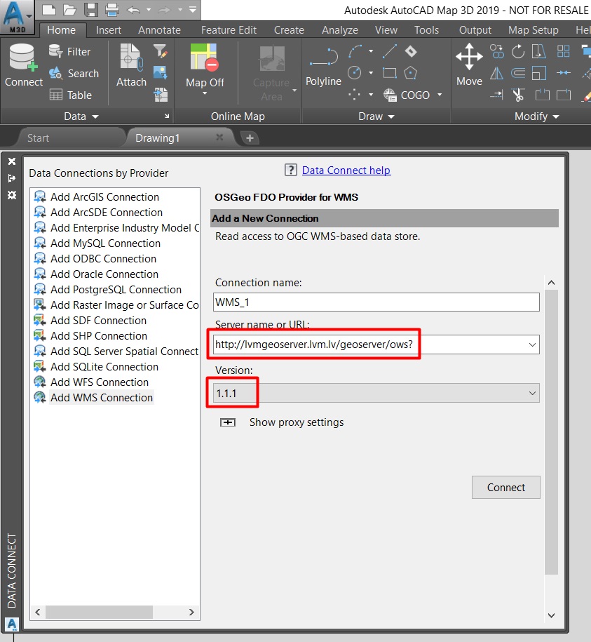
To use the WMS service, AutoCAD software must create a new WMS connection using the link
http://lvmgeoserver.lvm.lv/geoserver/ows?
Sample of WMS Connection Settings:
The WMS service contains layers that are mandatory by reference to the source data of the source and are shown as follows:
Orthophoto map
Service is prepared using: Orthophoto map 1:10 000 data © Latvian Geospatial Information Agency, 2013.- 2017.
Infrared Orthophoto map
Service is prepared using: Infrared Orthophoto map 1:10 000 data © Latvian Geospatial Information Agency, 2013.- 2017.
Digital terrain model, digital terrain slope model, canopy height model, canopy crown height model
Digital terrain model, digital terrain slope model, canopy height model, canopy crown height model services are prepared using: Digital terrain model source data © Latvian Geospatial Information Agency, 2016. Reference is mandatory.